By Danielle Prokop / Source NM
The respite from intense, deadly heat waves won’t last long. And it looks like the monsoon will suffer for it, according to New Mexico forecasters.
Globally, July has been the hottest month in recorded history, a preliminary analysis from international science organizations found. The data will be fully published in August, but the analysis shows it’s the hottest July on record – and that these heat waves in the Southwestern U.S. and Mexico would have been nearly impossible without the effects of burning fossil fuels.
A drop in pressure allowed for scattered storms and short bursts of rain across the state, however, August is predicted to be hotter and drier than normal, according to the National Climate Prediction Center outlook released Monday.

New Mexico State University climatologist Dave DuBois said he’s hearing from climate science colleagues around the world that are also struggling with record-breaking heat in India and China.
He said the current trends globally and in New Mexico are worrying, not just for crops, but for wild plants and animals.
“Even if we do get a really wet September, it’s unclear how much that is going to help, when most of the season has already passed for greening up forage for natural species,” DuBois said.
The loss of key moisture means much of the state is sliding back into drought. Dry plants and hotter, drier temperatures raise the risks of wildfires outside of their typical season.
“Usually we have the monsoon bringing in higher relative humidities,” he said. “It takes a lot more energy to make a fire when the humidity is higher.”
Monsoon missing in action
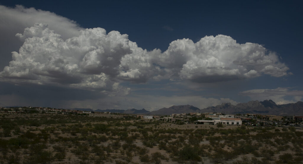
July was defined by a “non-soon” period, where the storms that build up in the late afternoons and evenings have been missing in action for much of the state.
While the dome of high pressure abated over the weekend, allowing storms to temporarily build up over mountains across the state, that pattern is predicted to end Thursday, as hot winds blowing back bring less chance for rain, forecasters with National Weather Service offices in Albuquerque and Santa Teresa said.

Instead of a monsoon season with any “strength or duration,” meteorologists said it looks like there may be long periods of hot dry weather, broken up with short periods of storms.
“It’s bleak because we’re not seeing the pattern setup that brings the moisture in and keeps it here,” said Tom Bird, a National Weather Service forecaster out of the Santa Teresa office.
July and August rains often account for about half of the state’s yearly rainfall for the southern portions of the state, and provide about a third of the rainfall totals for the rest of New Mexico.
Some long-range predictions show that September’s rain patterns could be closer to normal, but it isn’t easy to catch up.
“If we don’t get it now, during this period of time, it’s hard to catch up for the year,” Bird said. “We’re already well below normal on precipitation.”
Las Cruces has received just under an inch of rainfall since Jan. 1, instead of the more than 4 inches of rain it normally receives.
While rivers saw strong runoff from a wet winter, the lack of monsoon may soon hit them hard, said Andrew Mangham, a hydrologist in the National Weather Service Albuquerque office.
“I think that almost every river and every reservoir in the state is going to see some level of drying because we’re not getting consistent moisture almost anywhere,” Mangham said.
The only exception has been the Pecos River, he said. That’s in part due to the snowpack, but also the water flooding into the riverbed due to the burn scars of the Hermits Peak-Calf Canyon wildfires.
From rushing water to sandbed
Despite a good snowpack and high runoff, the Rio Grande is already slipping into sandbed. The San Acacia reach – which runs between Socorro and Elephant Butte Reservoir – dried more than 26 miles over eight days last week, said Carolyn Donnelly, who supervises water operations in Albuquerque for the U.S. Bureau of Reclamation.
The Rio Grande has been running high in other places, such as Española, where it meets the Chama River, or below Elephant Butte Dam, since its release in early June. However, New Mexico’s largest river could dry again through the state’s largest city, for the second time in about forty years, if the monsoons continue to be weak.
“We could see drying in Albuquerque as early as mid-August,” she said.
Donnelly said the drying is partially due to the fact that El Vado reservoir remains under construction for repairs, noting that water would usually be captured and stored there, to release throughout the summer.
Other rivers which ran strong during the record runoff, are also dwindling. The Santa Fe River, an ephemeral stream which provides some of the city’s water and feeds two acequias, has dwindled recently, said Alan Hook, who coordinates water resources with the the city of Santa Fe.
Without the rains to help keep the channel wet, or offer boosts to the amount of water flowing out of the mountains, it means the city has to limit how much water it provides to acequias.
“We conserve water and deliver water every other week, and wait out until the monsoons can get the river channel wetted again,” Hook said.
DuBois, the state climatologist, said the drought outlook is challenging on many levels.
“Oh boy, no, things are not looking good this year,” he said.

DANIELLE PROKOP
Danielle Prokop covers the environment and local government in Southern New Mexico for Source NM. Her coverage has delved into climate crisis on the Rio Grande, water litigation and health impacts from pollution. She is based in Las Cruces, New Mexico.