By Hannah Grover/ NM Political Report
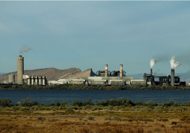
A new study published this month examines how the petrochemical industry in the Permian Basin has deformed the landscape by causing some areas to sink while other areas rise.
While the changes may not be easily noticeable, especially in sparsely populated areas like the Permian Basin, researchers say they can damage infrastructure.
The study by researchers from Southern Methodist University was published in the August edition of the International Journal of Applied Earth Observation and Geoinformation.
In their investigation, the researchers from Southern Methodist University sought to map the surface deformation across the Permian Basin and to quantify the relationship between oil and gas operations and the changes to the surface.
They found, on average, the ground in the Permian Basin is subsiding at a rate of three to four centimeters annually, though there are several pockets with larger rates of subsidence.
The researchers write in the study that, over the past few decades, the increase in oil and gas extraction has “contributed to the alarming increase in geohazards, sometimes permanently altering the local ecosystem, and is a growing concern for communities and policymakers worldwide.”
They say it is important to understand “the dynamics of geohazards at various stages in production.”
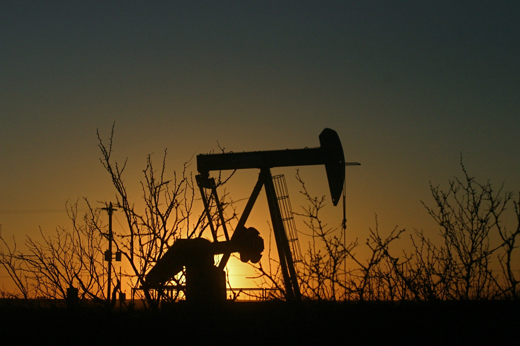
The Permian Basin is an important area to study because about 40 percent of the oil production in the United States occurs there.
Dr. Zhong Lu, a professor at Southern Methodist University who has been studying land deformation in the region, said in an email response to questions from NM Political Report that the geology of the Permian Basin is relatively stable and, under normal conditions, the landscape would not experience what is known as subsidence, or sinking of the surface ground due to changes in subsurface conditions.
“The Permian Basin, along with the rest of the US mid-continent, has long been considered geologically stable with no large-scale tectonic movement, volcanism, or seismic activities. Thus, natural geohazards are relatively uncommon,” Lu said.
But, approximately 100 years of extractive industry in the Permian Basin has changed that.
Now the basin is experiencing sinkholes, subsidence and uplifts as a direct consequence of the oil and gas activities.
Impacts of landscape changes
These changes in the landscape do not occur at a uniform rate. That means a plot of level ground may change so that one area is higher than an adjacent area. This can have various effects on infrastructure, architecture and even water sources.
The study’s first author Vamshi Karanam, a doctoral student at Southern Methodist University, gave a few examples of how these changes in the land’s form can impact humans.
Uneven changes in the surface can damage pipelines or even disrupt flow within those pipelines, he said.
In Pecos, Texas, and other Permian Basin communities, residents have seen their homes and businesses damaged by the changing lands.
As many of the abandoned oil wells are more than 50 years old, cracks can form in the cement and corrosion can take place in the oil pipes. These can result in wastewater leaking from a previously sealed and isolated formation into the groundwater or even onto the surface, he said.
Karanam said the oil and gas activities also increase the seismic activity in the basin and can induce the formation of sinkholes.
It’s not new news that the Permian Basin’s oil fields have a sinkhole problem. In 2020, Undark published a story about the sinkholes in New Mexico’s Permian Basin. But the research that the team at Southern Methodist University is conducting provides a better understanding of how the oil and gas industry in the Permian Basin is changing the landscape and at what rates.
To investigate the changes in the surface, the researchers used a remote sensing technique known as persistent scatterer interferometry as well as numerical modeling.
The study’s origins
The recent paper is not the first study Southern Methodist University researchers have published since they began investigating the deformation.
The research began in 2015 following the launch of the European Space Agency’s satellite Sentinel-1. At first, the researchers focused their attention on a sinkhole in Texas and attempted to use data from Sentinel-1 to investigate the ground stability. That later expanded to look at the impact of oil and gas operations across the Permian Basin.
The study published this month uses data acquired from Sentinel-1 from 2016 to 2021. By using the persistent scatterer interferometry, the researchers were able to create a time-series of deformation that is accurate to the millimeter.
They also used data about the extraction and injection rates at wells in the Permian Basin. This data came from the Railroad Commission of Texas, which oversees the oil and gas industry there, and the New Mexico Energy, Minerals and Natural Resources Department.
Their results indicate that there is about three to four centimeters of deformation annually and the region includes two large pockets of deformation.
The research has not only focused on active wells. Lu has also been involved in work documenting how abandoned wells that haven’t been plugged can influence ground instability and lead to geological hazards like sinkholes.
Lu and his team of researchers received a grant from NASA to investigate ground stability across the entire Permian Basin related to oil and gas.
Karanam joined the team in 2021 after enrolling in Southern Methodist University. He started working on radar image processing to investigate how the Permian Basin’s surface land is deforming.
This recent study is only one in a series of investigations that the researchers are conducting. These investigations will continue over the next couple of years.
An unusual finding
Karanam said the majority of the deformation features they observed have geological and geophysical explanations. But, a very large uplift west of the Delaware Basin—a subbasin of the Permian—and outside of the oil fields caught the researchers’ attention.
Uplifts are generally associated with the injection of fluids into the subsurface, but they tend to be localized. That means deformation caused by an oil or injection well will occur within a few miles of the well itself.
The uplift west of the Delaware Basin spreads out across an area of thousands of square kilometers and there are no active injection wells nearby.
“It is possible that the years of production in the Delaware Basin have resulted in loss of mass and the surface is slowly bouncing up,” he hypothesized. “This phenomenon is similar to the post glacial rebound effect.”
But, Karanam said, confirming that hypothesis will require further studies using detailed geophysical models.
The team at Southern Methodist University is planning on extending its current research on the Permian Basin, so it may be able to answer that question in the future.
Karanam said the team hopes to eventually map the deformation over time starting with the early 1990s using satellite data and to quantify how hydrocarbon operations impact surface deformation.
“This can help us understand the history of the deformation in the basin and can also provide insights into the delayed effect of subsidence,” he said.
How geology impacts deformation
The geology itself changes how much deformation will occur.
For instance, if there is a lot of salt in the subsurface geology, contact with fluids can cause the salt to dissolve and this can lead to the ground level sinking, Lu said.
The depth of the wells can also impact deformation, he said, adding that more deformation will occur over larger areas with deeper wells.
Other geological factors such as how porous or permeable the rocks are and how the subsurface responds to pressure or compression can also determine how much the surface deforms.
The type of oil and gas process can also have an impact. Extraction can lead to sinking levels of land and injection can create an uplifted area near the well.
Karanam said injecting something like produced water adds volume to the subsurface, which requires the land to uplift to accommodate for that increased volume.
“The injected water can also change the stress regime in the subsurface and can cause fault slip resulting in earthquakes,” he said.
Possible solutions
The best way to reduce the amount of land deformation is to reduce extraction and injection activities, but, Karanam acknowledged, that might not be an economically viable solution.
Both New Mexico and Texas rely heavily on the oil and gas industries, particularly in the Permian Basin.
Karanam said a feasible solution could be carefully planning hydrocarbon operations with a focus on controlling the damage to the geology and the infrastructure. In other words, focusing on planned subsidence, which allows the ground to subside in a predictable and controlled manner. He said mining operations often employ this concept. For example, the final environmental impact statement released in 2019 for northwest New Mexico’s now shuttered San Juan Mine looks at ways to minimize the subsidence associated with underground mining.
“This can help relevant agencies in reducing the impact of subsidence on the infrastructure,” he said.
To do this, it requires detailed mapping of subsurface formations and fault structures as well as hydrogeological models that help people understand how fluids move around in the subsurface geology.
State Land Commissioner reacts
After reading the study, New Mexico Land Commissioner Stephanie Garcia Richard consulted with her staff on the impacts. Her primary concern is pipeline safety and she said the results of the study are something that regulatory agencies should consider when making decisions.
“Three to four centimeters a year in subsidence feels significant,” she said, adding that it’s “kind of a scary thing to contemplate” how much of an impact the oil and gas activity has on the ground.
She said the State Land Office believes about 230,000 acres of state land are impacted by the subsidence.
“We already know that because of the salt formations in this area there is the potential for sinkholes,” she said.
Garcia Richard highlighted a sinkhole that formed in Carlsbad as an example.
“That one is not on state land, but we do have other instances of subsidence that we are keeping an eye on and monitoring,” she said.
For Garcia Richard, the study raised more questions that she would like to see answered. For instance, she wants more information about how different oil and gas extraction techniques impact the levels of deformation and how differences in regulations in New Mexico and Texas may change how much the lands are impacted by oil and gas activities.
The study does note some differences in the two states, including the fact that most of the injection is occurring in Texas. This is in part due to state policies. Garcia Richard explained that oil and gas operators in New Mexico are not able to inject into shallow wells. Instead, they must inject into deep formations.
But, she said, salt water injection is something that people should keep an eye on not only because it can lead to uplift of the surface but also because it has been tied to increased seismic activity.
The study also notes that some of the areas of subsidence in New Mexico are related to potash mining, which Garcia Richard also highlighted. According to the study, the impacts of potash mining are decreasing. Between 2007 and 2011, potash mining led to a subsidence rate of about 100 centimeters per year. That decreased to 4 centimeters per year during the time that the researchers were conducting the study. The researchers tied the decrease in mining subsidence to an oversupply of potash on the international markets, leading to a reduction in mining operations in New Mexico.
Garcia Richard also also expressed interest in learning more about any potential changes that might have occurred as oil and gas companies switched from vertical drilling to horizontal drilling.
Much of the steps that could be done to address the subsidence, such as requiring planned subsidence, is outside of the State Land Office’s jurisdiction. That could be done by a rulemaking process in the Oil Conservation Division or by legislation at the state level.
But, Garcia Richard said, it is important to take into account the impacts of the oil and gas industry on state lands.
“We exist to make money for public schools. But if the activities that we’re doing on the lands are putting New Mexicans in harm’s way, then our work is meaningless,” she said.